

SYLACAUGA, Ala. – In the last couple of weeks, an effort to add a sizeable portion of the Pinhoti Trail to the tail end of the Appalachian Trail has formed.
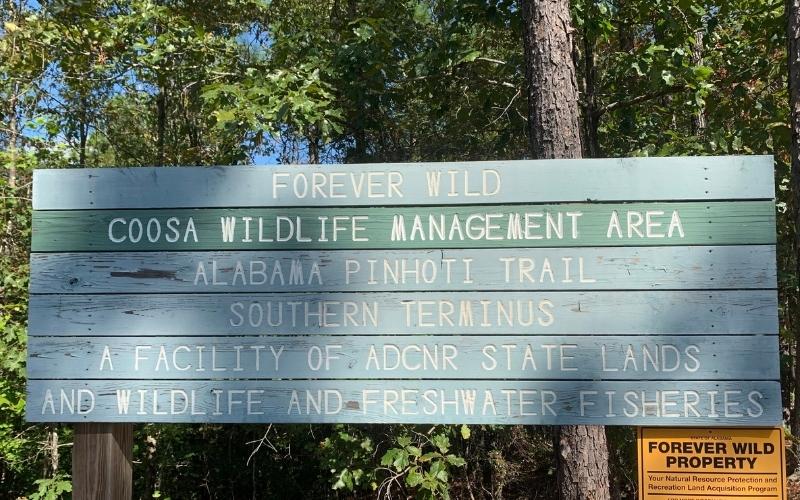
The Pinhoti Trail is a 339-mile hiking trail that runs through east Alabama and northwest Georgia. It sits alone as its own trail with the southernmost point being at Flagg Mountain in Weogufka and the Northern Terminus connecting to the Benton MacKaye Trail. The Appalachian Trail connects to the Benton MacKaye Trail at Springer Mountain in Georgia.
Over the years, there have been multiple pushes by different state conservation officials and groups to combine roughly 250 miles of the Pinhoti Trail into a new Southern Terminus of the Appalachian Trail. This would leave the Pinhoti Trail at around 80 miles.
This conservationist effort has come back to the forefront once again.
According to Pinhoti Outdoor Center owners Nathan and Kimm Wright, it’s the opposite of what the vast majority of avid hikers want.
“It’s important that we maintain the identity of the Pinhoti [Trail],” said Kimm Wright. “We’re trying to educate people that you can connect them. You don’t have to combine them. Some of the people that are pushing for it, they are not hikers. Most of the hikers that [Nathan and I] know are not excited about it.”
Nathan Wright believes that the only aspect that can be seen as positive in all of this is the monetary gain. He also believes the Pinhoti can do that on its own.
“Some fundraisers in Birmingham, I think they’ve sold this idea to the state parks.” Nathan expressed.
A website that you can check out here was created by the group in support of the change. It lists the reasoning behind the desired combination of the trails which includes stating that this was the original intent of Benton MacKaye, the famed American outdoorsman that envisioned the Appalachian Trail back in 1921. According to the Nathan and Kimm, this is “simply untrue.”
“He originally wanted to go to Mount Mitchell in North Carolina,” explained Nathan. “What the folks are referencing is a map which was drawn in the early 1900s. There’s a double line coming down to Birmingham, and that’s what they’re grasping on to. Well, if you look at the legend on that map, it’s a railroad. There’s no evidence, no indication this is what [Benton MacKaye] wanted.”
This proposition to change the Appalachian Trail Southern Terminus is not welcomed by “practically any hiker” according to Nathan Wright. Quite possibly the most noteworthy Pinhoti Trail advocate, M.J. “Nimblewill Nomad” Eberhart, has not only expressed his distaste of the idea; he’s had his own words of keeping the Pinhoti intact used against him recently.
“We’re working really closely with him,” said Nathan. “His image and his hike from last year has been misinterpreted. It has been insinuated that this is what he wants, and it is exactly the opposite of what he wants.”
Nimblewill shares his thoughts about the potential trail combination on his blog. There’s also a link to a Change.org petition which has over 1,600 signatures.
It’s not just long-standing members of the hiking community that the change will affect. Newcomers to trail hiking all the way up to seasoned veterans wish to participate in something called “bagging trails.” This is where you collect as many completions of trails as one can.
“If you move the Southern Terminus down to Cheaha [State Park], you’re now negating two trails,” Kimm Wright said. “Instead of hiking the Pinhoti Trail, the Benton MacKaye Trail, and the Appalachian Trail, now you’re just hiking one. It makes a difference to a hiker.
For Kimm, the message for all is clear: “Connect, don’t combine.”
“We love the Pinhoti,” professed Kim. “We think the Pinhoti can hold its own, and we don’t think there’s a reason to change the goodness of the AT (Appalachian Trail). It’s not like you have to rebuild trails. It’s already there. Just leave it be. You don’t have to change anything.”


