


BIRMINGHAM, Ala. – The National Weather Service in Birmingham has issued a Hard Freeze Warning starting Tuesday, Jan. 16 at 9:00 p.m. through Thursday, Jan. 18 at 9:00 a.m.
The official advisory is below:
ALZ011>015-017>050-170600-
/O.UPG.KBMX.HZ.A.0001.180117T0300Z-180118T1500Z/
/O.NEW.KBMX.HZ.W.0001.180117T0300Z-180118T1500Z/
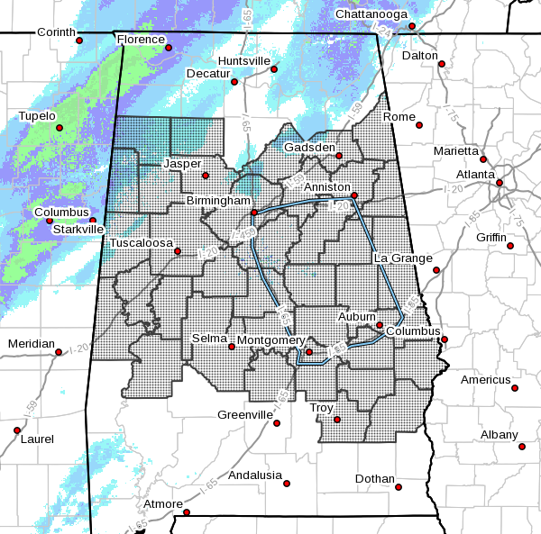
Marion-Lamar-Fayette-Winston-Walker-Blount-Etowah-Calhoun-
Cherokee-Cleburne-Pickens-Tuscaloosa-Jefferson-Shelby-St. Clair-
Talladega-Clay-Randolph-Sumter-Greene-Hale-Perry-Bibb-Chilton-
Coosa-Tallapoosa-Chambers-Marengo-Dallas-Autauga-Lowndes-Elmore-
Montgomery-Macon-Bullock-Lee-Russell-Pike-Barbour-
Including the cities of Hamilton, Sulligent, Vernon, Fayette,
Double Springs, Jasper, Oneonta, Gadsden, Anniston, Centre,
Heflin, Carrollton, Tuscaloosa, Birmingham, Hoover, Columbiana,
Pelham, Alabaster, Pell City, Moody, Talladega, Sylacauga,
Ashland, Roanoke, Livingston, Eutaw, Greensboro, Moundville,
Marion, Centreville, Clanton, Rockford, Alexander City,
Dadeville, Valley, Lanett, Lafayette, Demopolis, Linden, Selma,
Prattville, Fort Deposit, Hayneville, Wetumpka, Tallassee,
Montgomery, Tuskegee, Union Springs, Auburn, Opelika,
Phenix City, Troy, and Eufaula
1112 AM CST Tue Jan 16 2018
…HARD FREEZE WARNING IN EFFECT FROM 9 PM THIS EVENING TO 9 AM
CST THURSDAY…
The National Weather Service in Birmingham has issued a Hard Freeze Warning, which is in effect from 9 PM this evening to 9 AM CST Thursday. The Hard Freeze Watch is no longer in effect.
* TEMPERATURES…A range of 9 to 20 degrees is expected Wednesday morning. A range of 12 to 19 degrees is expected Thursday morning.
* Impacts…prolonged exposure to these temperatures could result in exposed water pipes freezing and possibly bursting, as well as killing sensitive vegetation.
PRECAUTIONARY/PREPAREDNESS ACTIONS…
A Hard Freeze Warning means temperatures of 15 to 20 degrees or below are imminent or highly likely. These conditions will kill crops and other sensitive vegetation.